My research agenda is related to governance and development in Mexico and Latin America
Introduction: Poverty
The topics covered in the first session were the following:
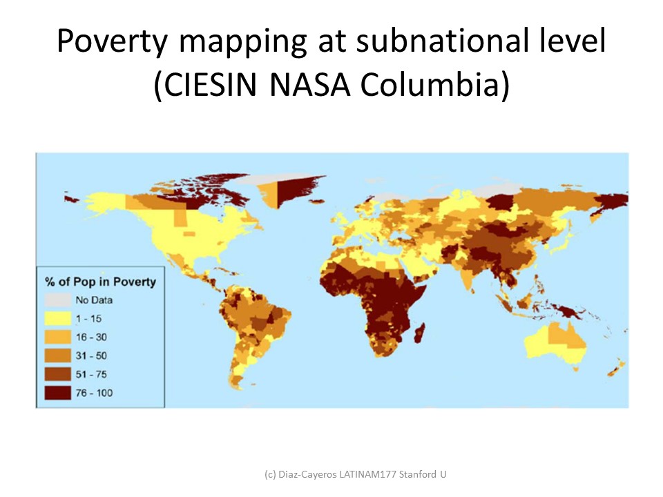
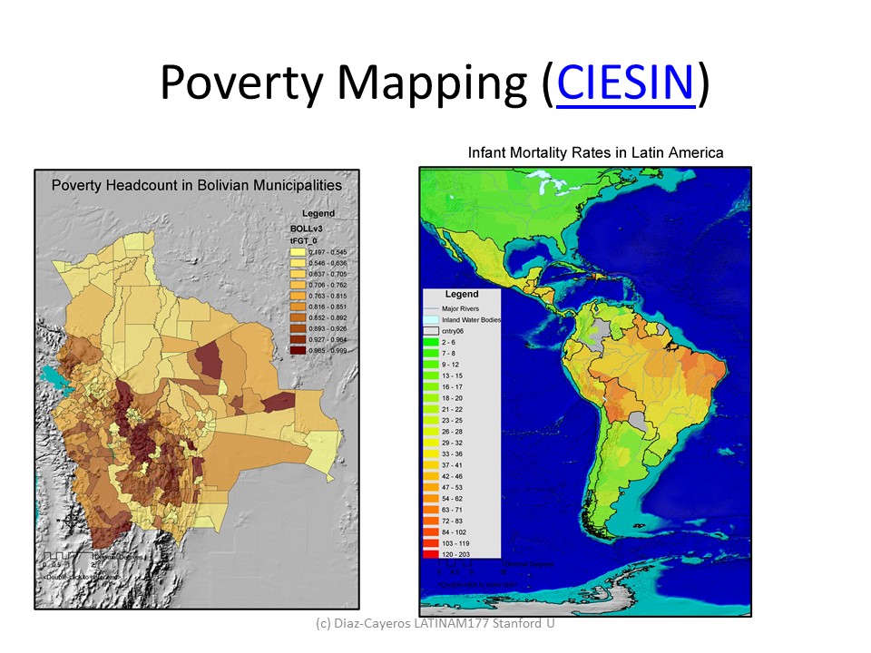
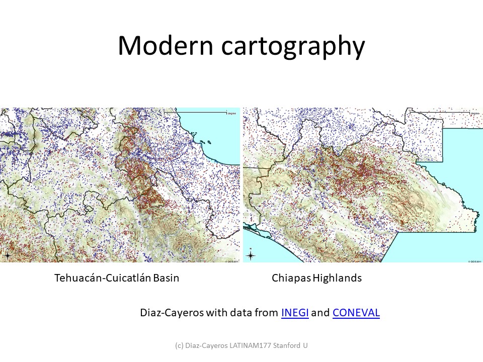
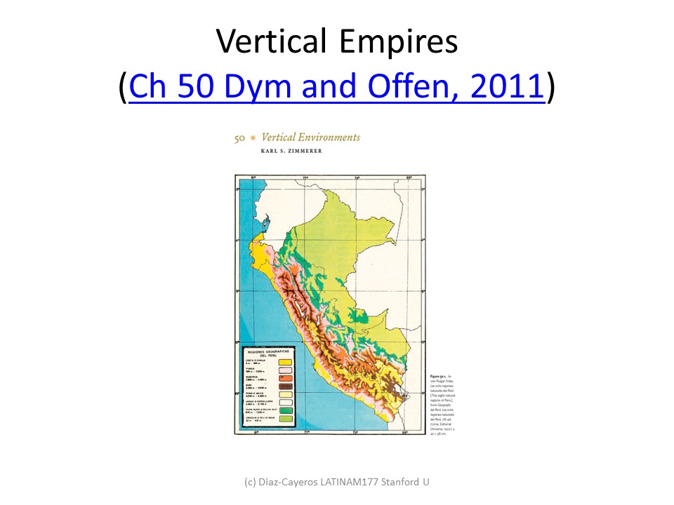
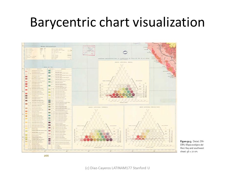
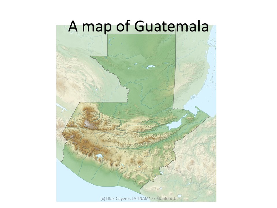
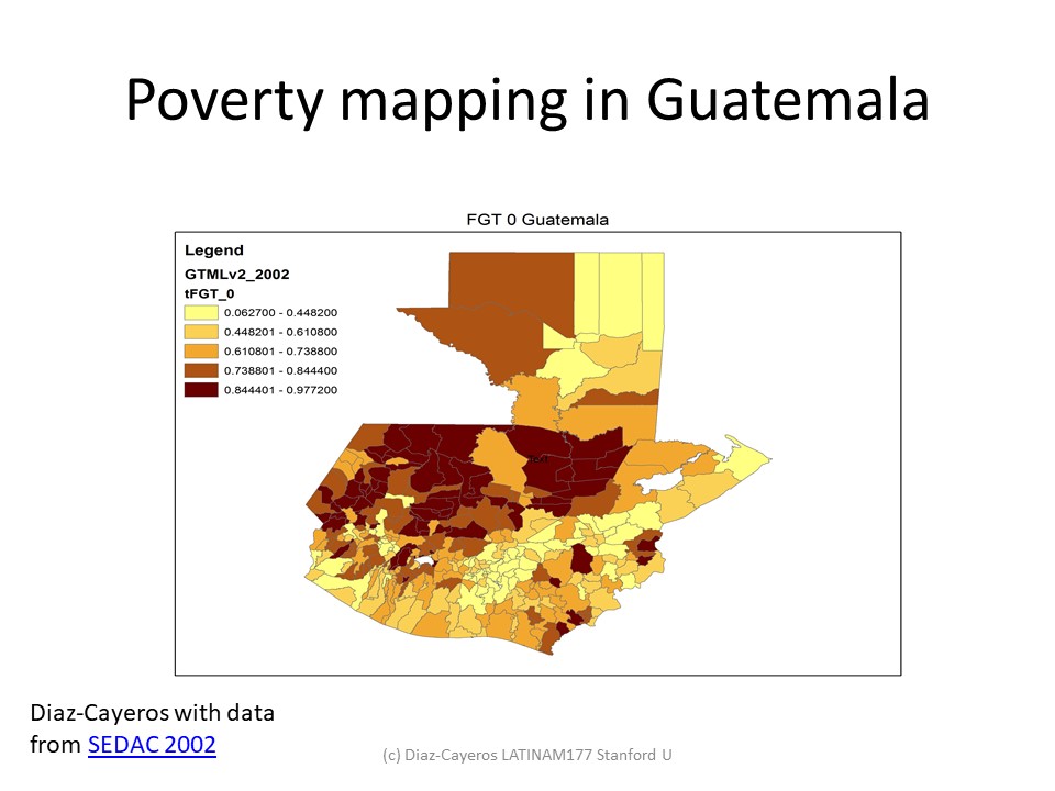
Cloropleth maps of poverty (World, Bolivia, Guatemala, Southern Mexico)
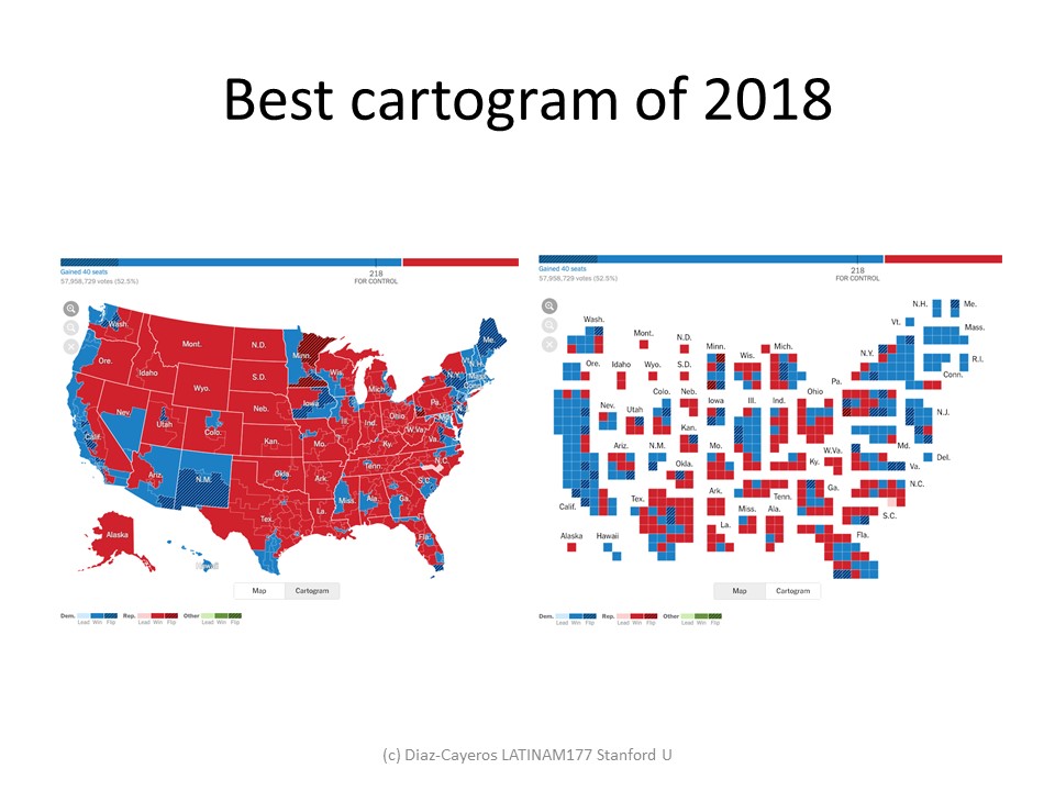
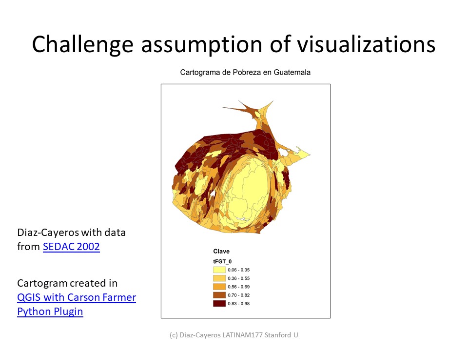
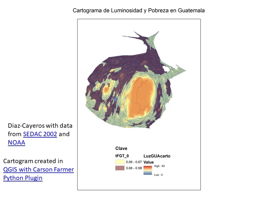
Cartograms (World in 1940, 2018 US election and Guatemala)
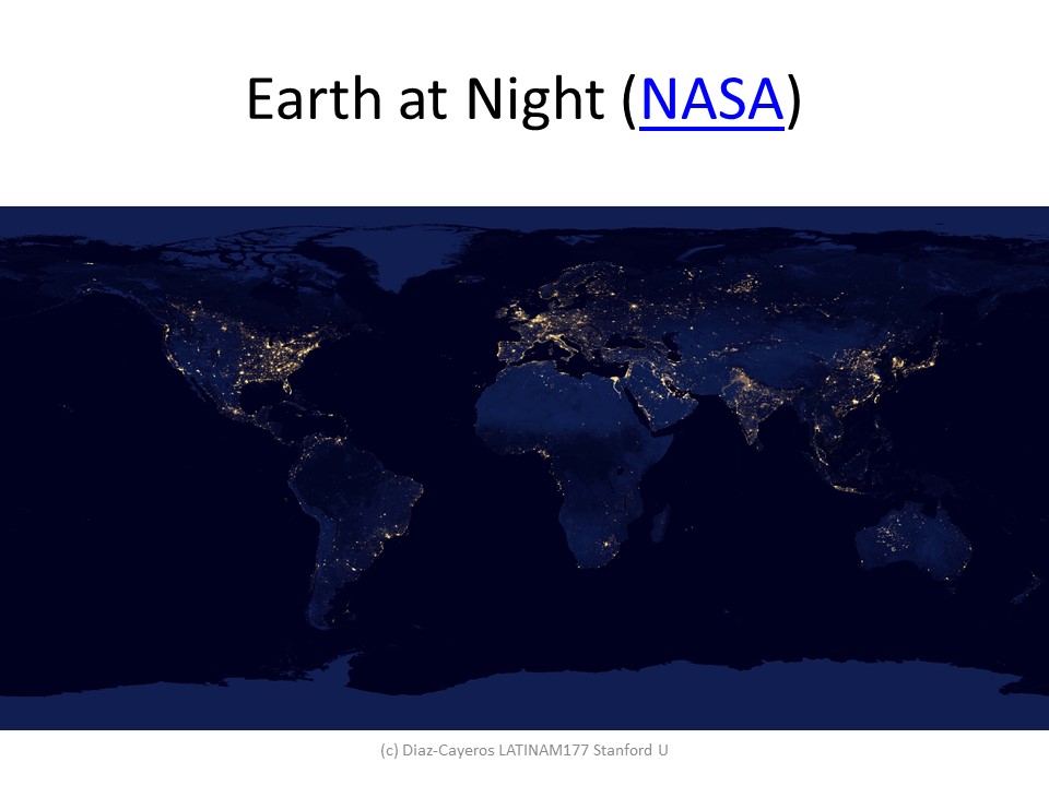
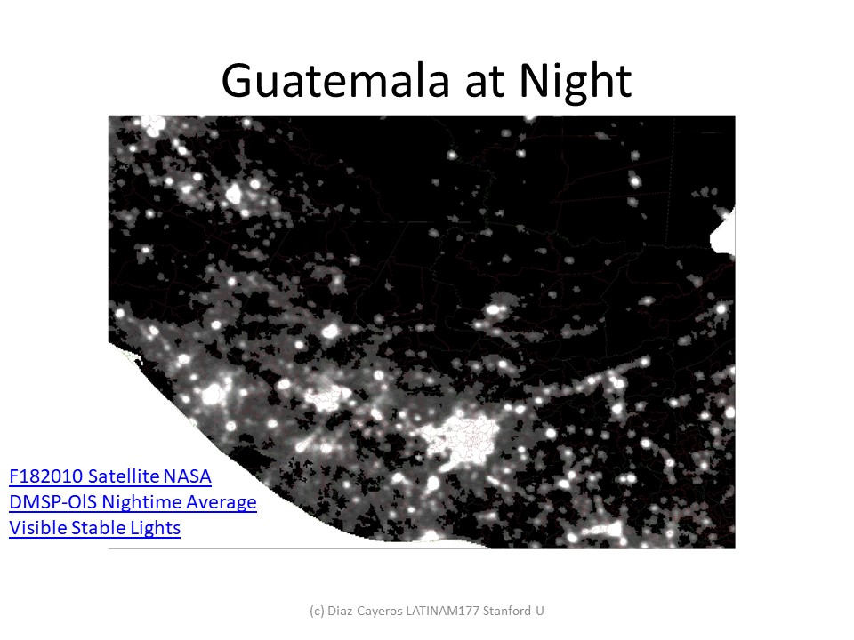
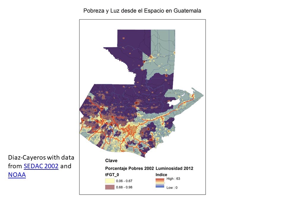
Night lights and poverty mapping (also daytime imagery)
Overlaid layers in Geographic Information Systems for Guatemala
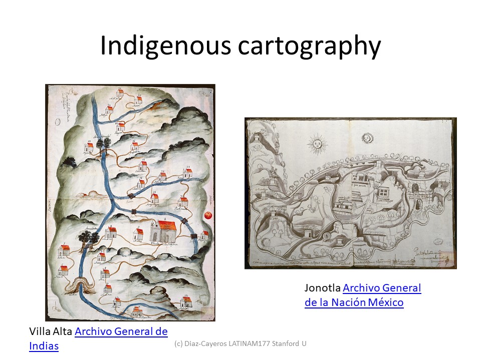
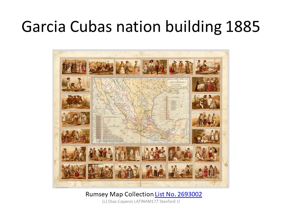
Indigenous cartography (Quauhquechollan)
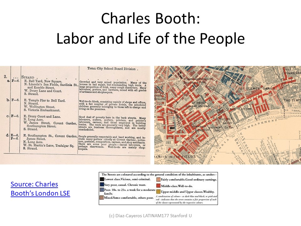
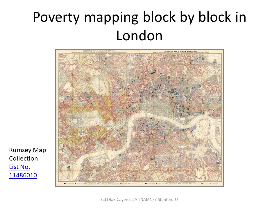
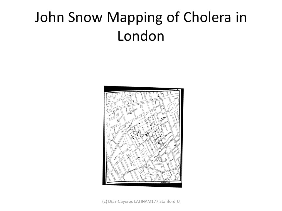
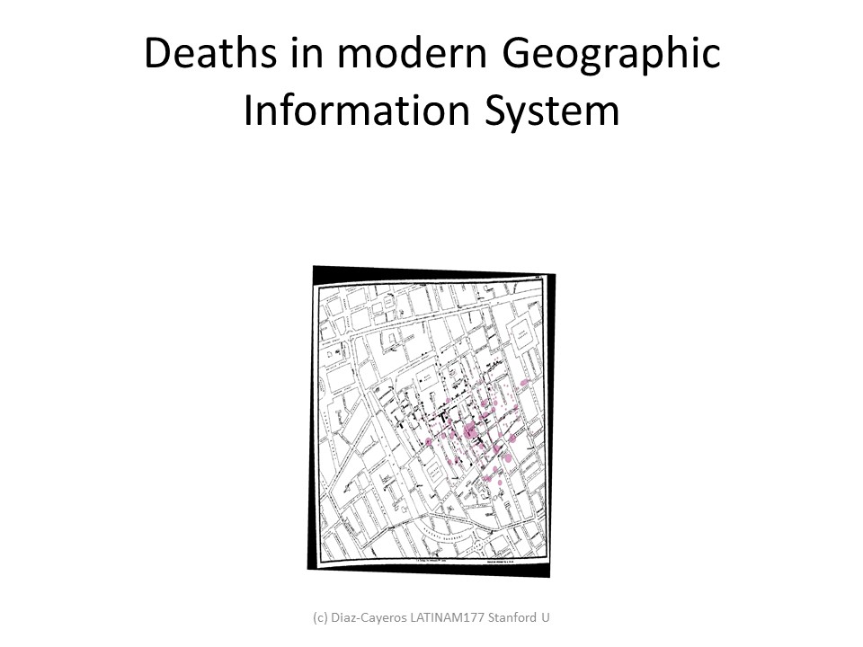
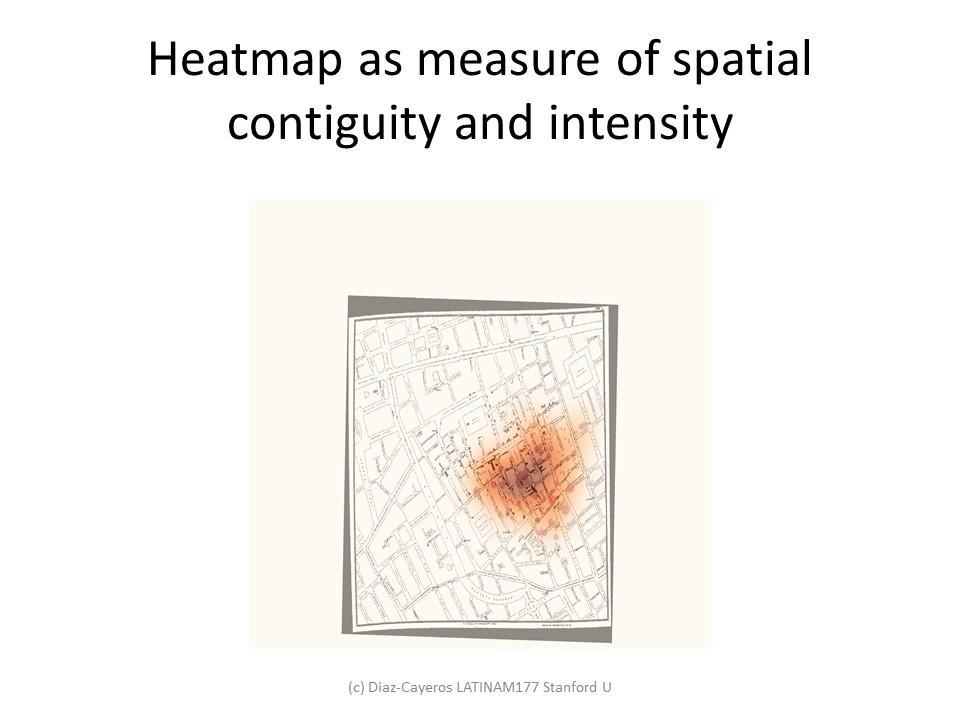
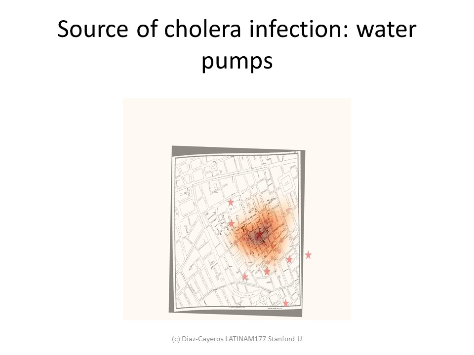
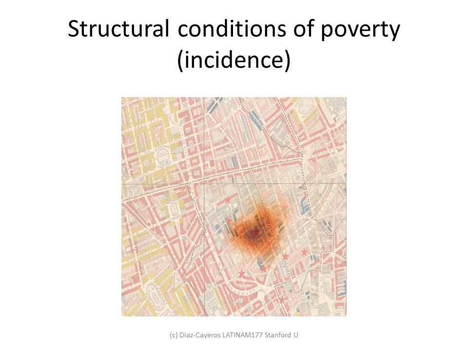
Charles Booth poverty mapping and John Snow cholera maps of London
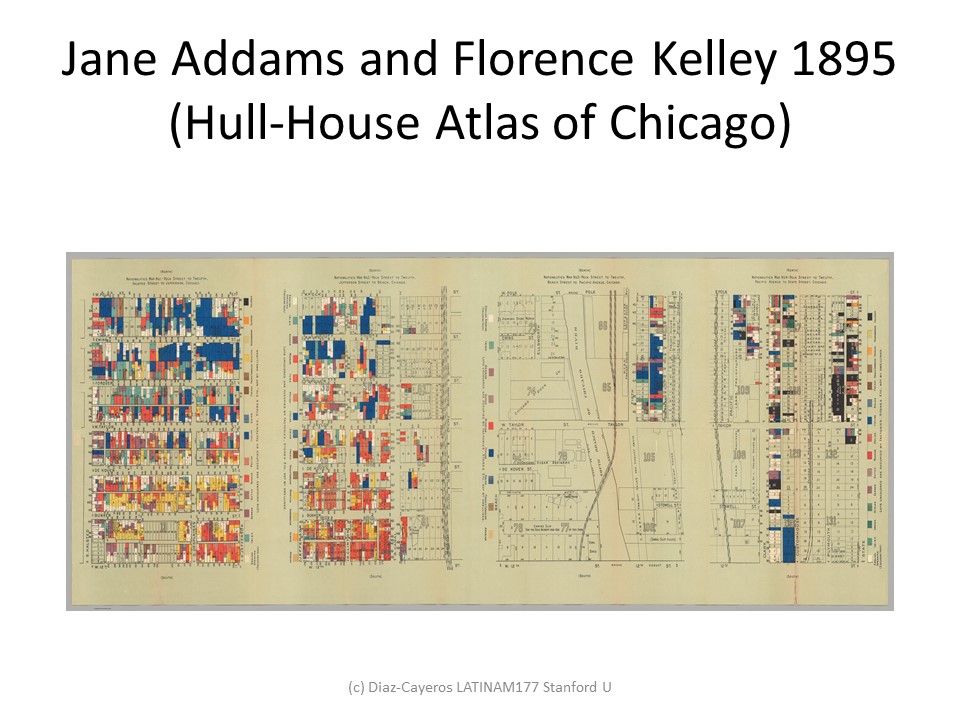
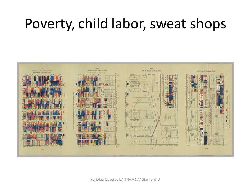
Ethnicity and poverty (Jane Addams and Florence Kelley Chicago)
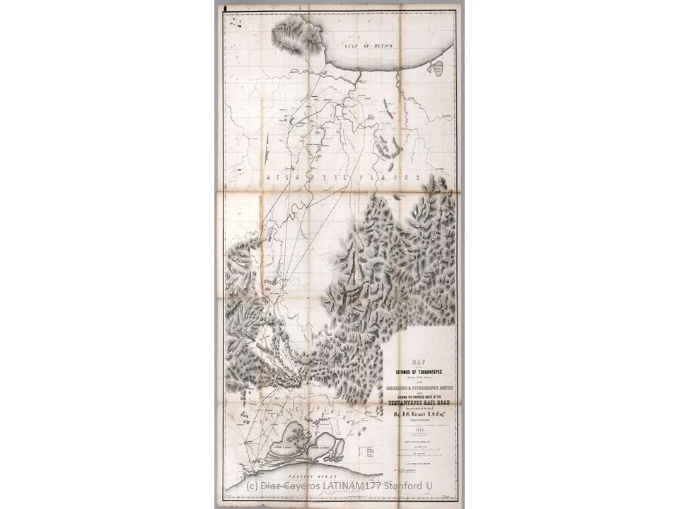
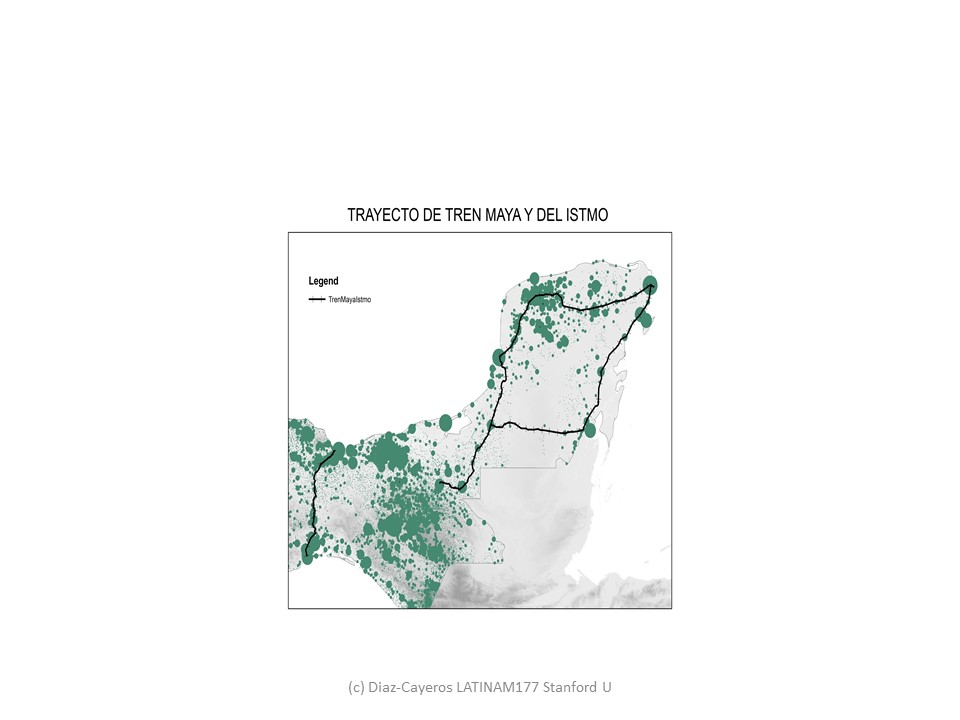
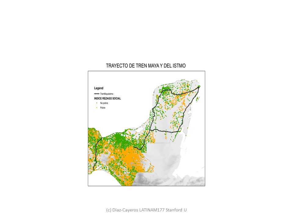
Tren Maya and the Istmo de Tehuantepec development projects (Mexico)
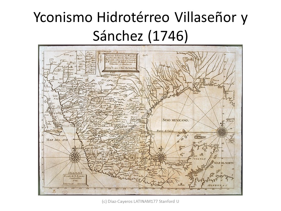
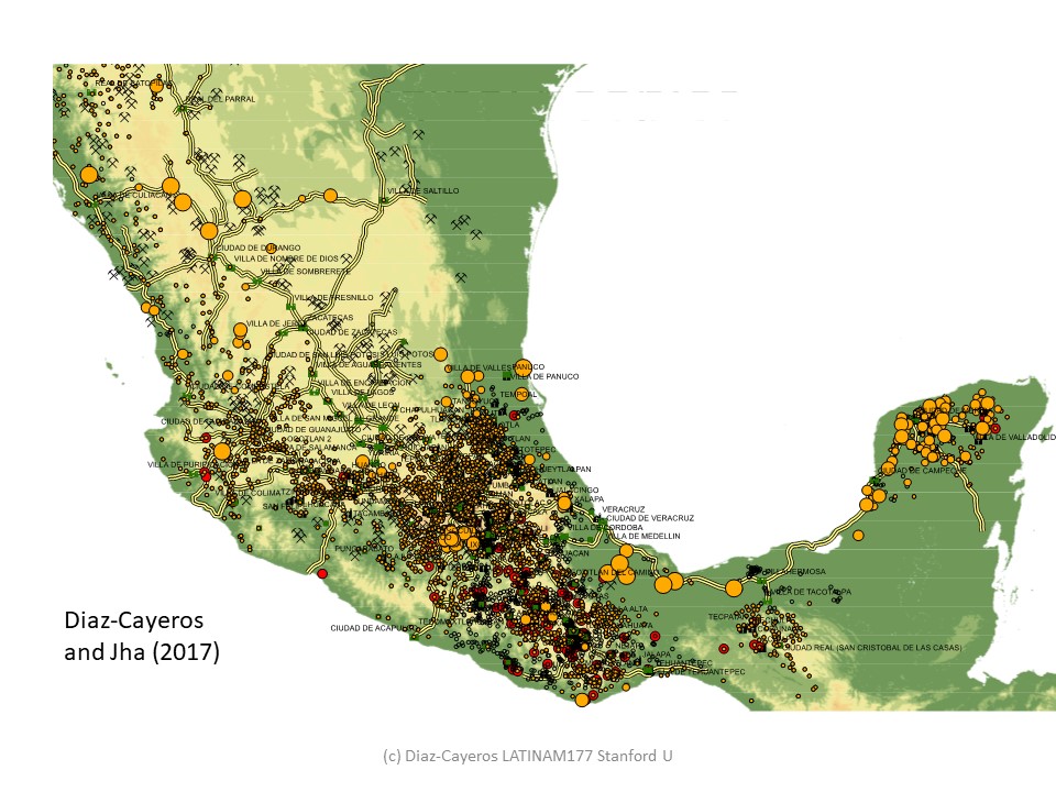
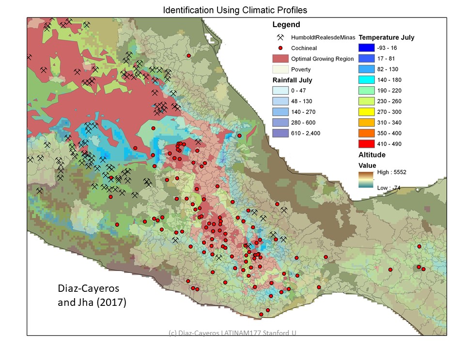
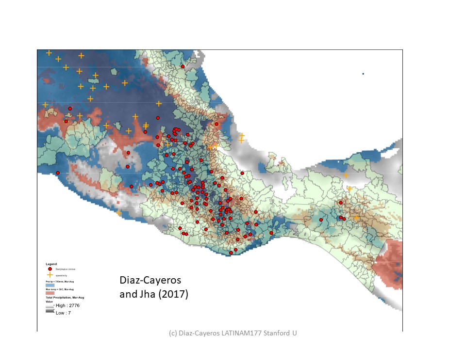
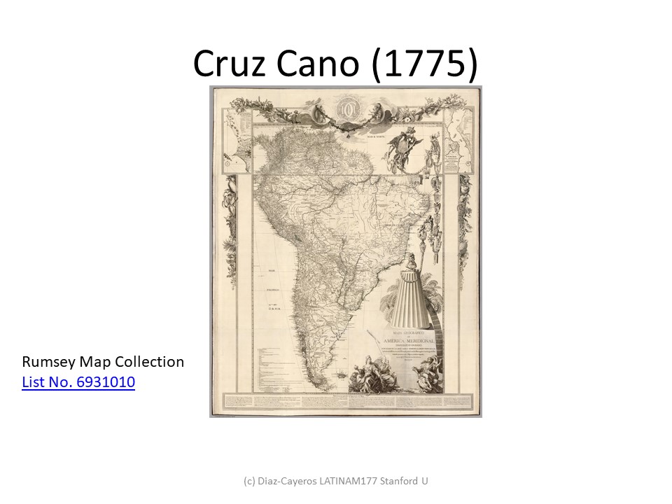
Indigenous communities and colonial development (cochineal in New Spain)
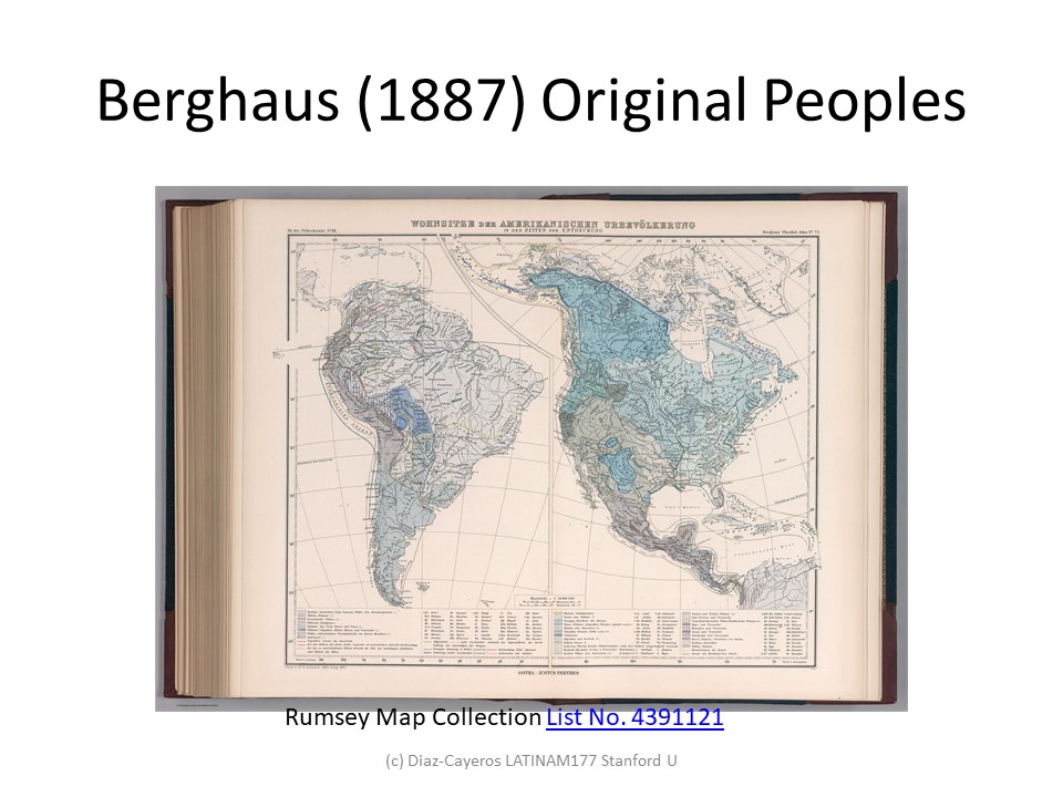
Poverty, ethnic diversity and indigenous communities in Latin America